
Written by: Hanif Satrio Dwiandoko (15119076) and Farras Hafizh Rizqy (15119071)
Since the birth of Electronical Navigational Charts (ENC) in the early 1990s, the International Hydrographic Organization (IHO) released the S-57 standard as digital hydrographic data has become a critical element in ensuring safety in marine navigation. In response to the developments in the world of geospatial information, the IHO released the S-100 standard, which is a new universal hydrographic data model designed to be compatible with the latest geospatial data standards. The goal is to display various kinds of hydrographic and oceanographic information on the Electronic Chart Display and Information Systems (ECDIS) for more precise navigation. The main objective of the S-100 standard is to build the digital twin of the ocean. This standard supports a wide range of hydrographic data types, for instance, bathymetric grids, water level information, and surface current data. Presently, the S-100 is not widely known, even implemented by the hydrographic industry nor the national hydrographic offices. The establishment of best practices in the conversion of S-100 data sets is necessary to accelerate the adoption of the standard by the wider hydrographic community.

The ocean digital twin of S-100
Fortunately, we’ve got the opportunity to work on the S-100 topic for our Undergraduate Thesis in the form of a Capstone Project. The project aims to design a process to convert digital hydrographic data, i.e., bathymetric surface, water level, and surface current data that conforms to the IHO S-100 series of product specifications. A conversion process is formulated as the product of this project, completed with the design criteria and a toolbox conversion of the S-100 data sets. ENC No. 293, which covers the Alas Strait area, West Nusa Tenggara, is used as our study area. Our team consists of four 2019 undergraduate students: Alvin Amanda, M. Daffa Rizki El-Islami (Daki), Hanif Satrio Dwiandoko, and Farras Rizky Hafizh. We are very grateful to be supervised by our dedicated lecturers: Ir. Dr.rer.nat. Poerbandono, Ir. Dr.rer.nat. Wiwin Windupranata, Miga Magenika Julian, M. T., and Gabriella Alodia, Ph.D.
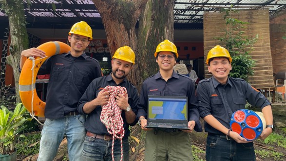
The S-100 Capstone Team! From left to right: Alvin, Daki, Hanif, and Farras.
As the national hydrographic authority, the Indonesia Hydro-Oceanographic Centre (Pushidrosal) prepares for the transition of the S-100 standard adoption to be used in Indonesian marine navigation system. The roadmap is to partially operate the S-100 and S-57 standard on ECDIS by 2026 and completely switch to the S-100 standard by 2029. To support this plan and create opportunities to build the digital hydrographic infrastructures with sources from various communities, Pushidrosal held a focus group discussion (FGD) with Institut Teknologi Bandung (ITB) with the topic of “Domestic Collaboration to Develop S-100 Data and Nautical Realm.” To discuss the implementation of the S-100 standard, Pushidrosal invited our Capstone Project Team to present the result of our Undergraduate Thesis. As for the Nautical Realm discussion, Pushidrosal invited a team from the Astronomy Study Program of ITB. The FGD was held on 19 June 2023.
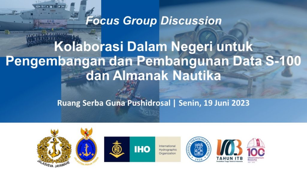
Pushidrosal’s Focus Group Discussion (FGD)
During our presentation, we showed that the S-100 data conversion for bathymetric grid, water level, and surface current data can be carried out using open source tools and programming language, e.g., Python. However, there is still a caveat on the results of this project. Among them are: (1) The data conversion tool is still in the form of a program script in Python, not in a user-friendly interface, (2) Only bathymetric data set was successfully converted into the required format, (3) A standard format design for data input is required, and (4) There is no quality control in the form of accuracy test for the converted data set.
Top left: Hanif presenting the Undergraduate Thesis results. Top right: Instructions from the Commander of the Indonesian Hydro-Oceanographic Centre (Danpushidrosal). Bottom: Dr.rer.nat. Poerbandono taking part in discussions.
For the moment, our project was carried out only by complying to the S-100 standard. To apply the standard to real marine navigation environment, it is also important to understand the business process of digital hydrographic data for navigation purposes. This FGD was a big step to understand the actual requirements needed to develop the S-100 data for practical use in marine navigation.
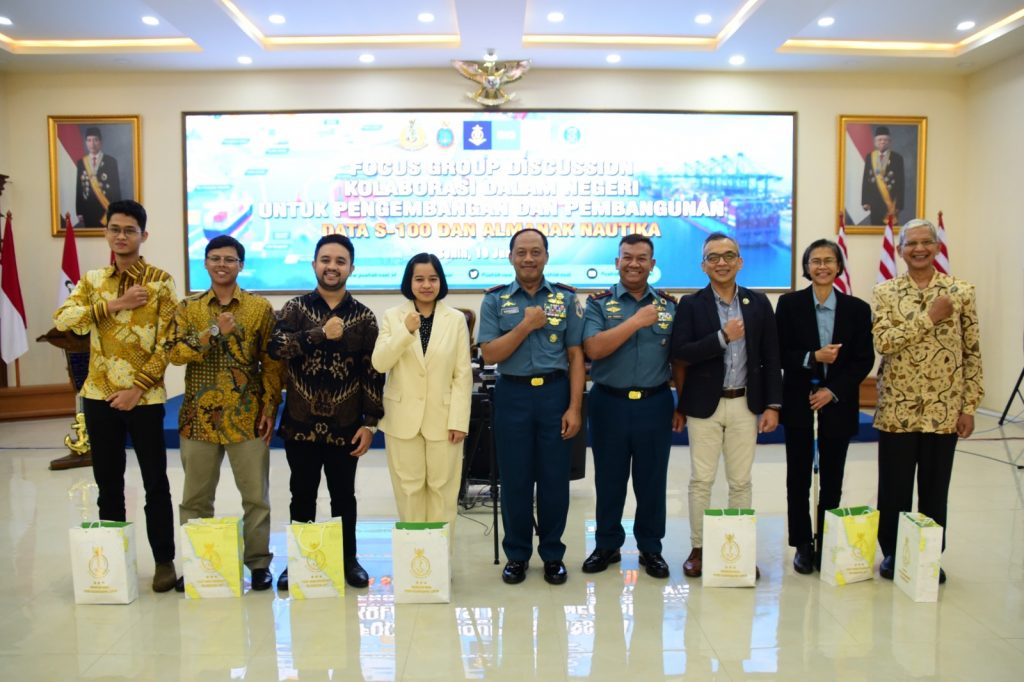
Presenters of the FGD with the Commander and Vice Commander of Pushidrosal
We’ve had a lot of positive feedback from the participants of this FGD. The main objective of our presentation was to propose the forming of a national working team to build and develop the infrastructure of S-100 data set. This team should consist of various parties, ranging from Pushidrosal as the national authority, academia, and professional working in hydrographic and marine-related industries. We sincerely hope that this ambition could be realized in the future.