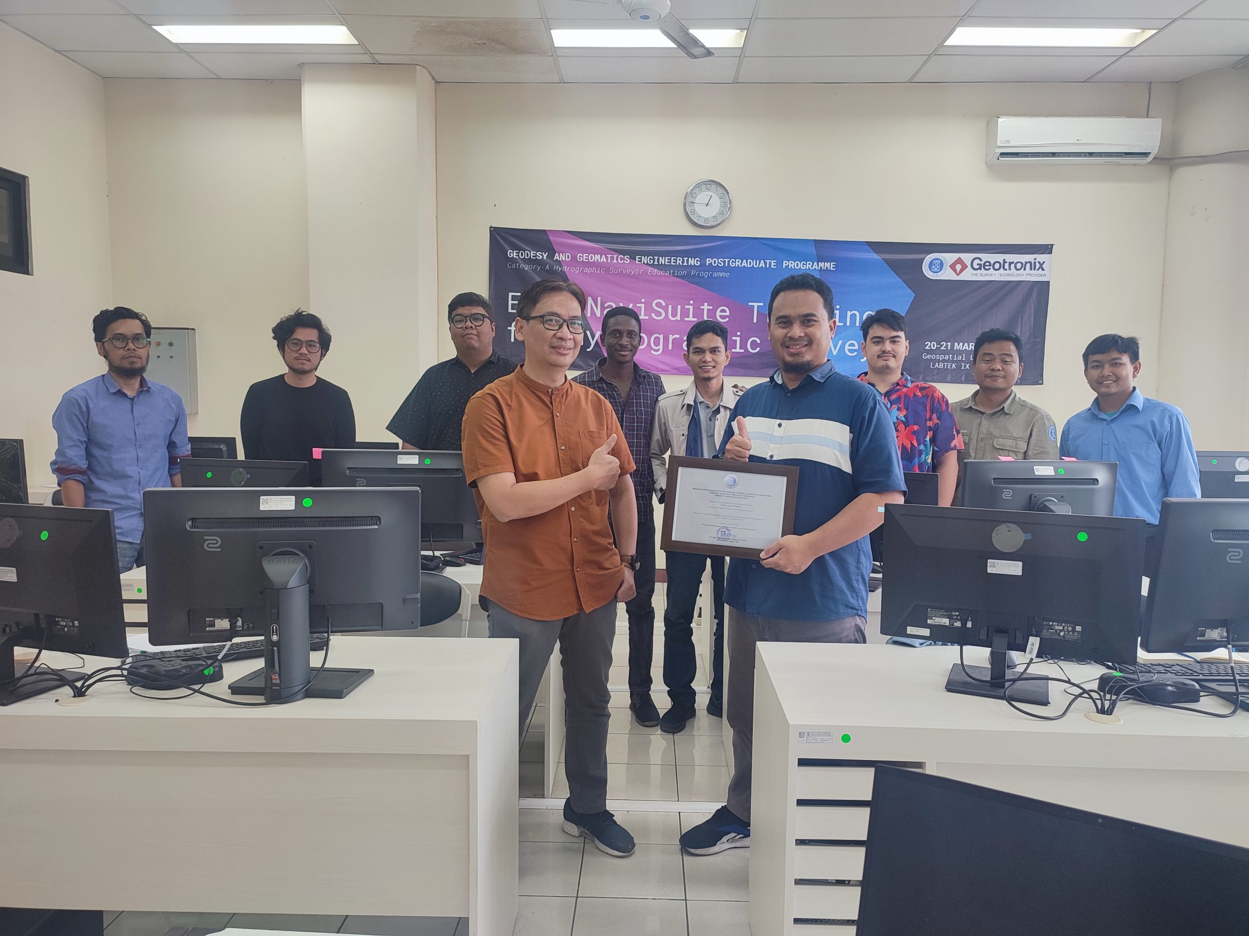
On 20-21 March 2023, Geodesy and Geomatics Engineering Postgraduate Programme held an in-house software training called the “EIVA NaviSuite Training for Hydrographic Survey.” The training was held as part of the H6: Hydrographic Data Acquisition and Processing Module for the Category A Hydrographic Surveyor Programme, as required in the FIG/IHO/ICA S-5A Standards. The training was facilitated by Mr. Wahyu Arif Wibowo, Product Manager of PT. Geotronix Pratama Indonesia.
EIVA NaviSuite Training for Hydrographic Survey
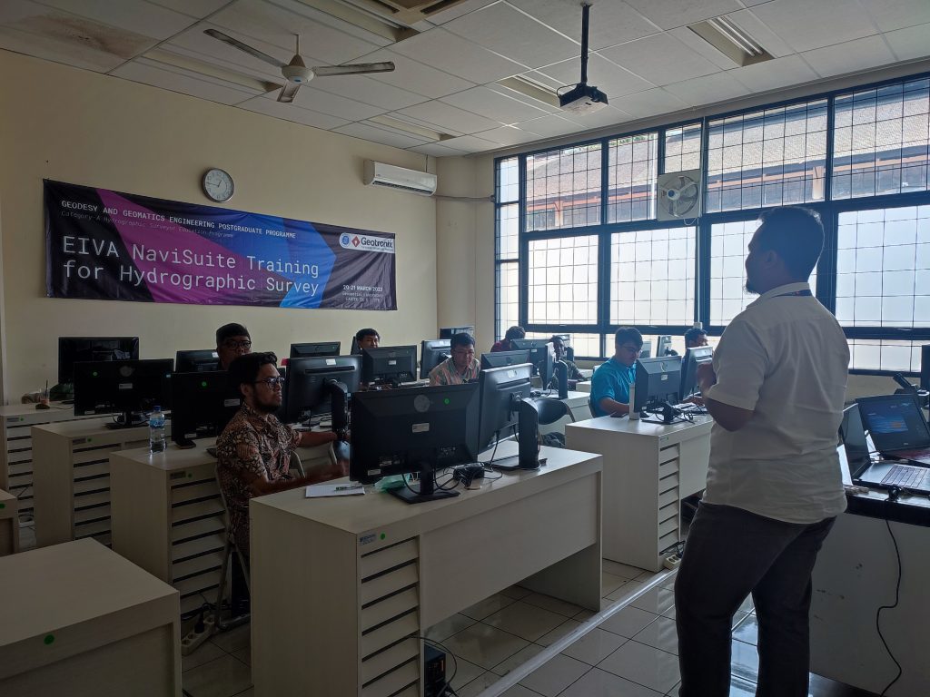
EIVA NaviSuite is a pack of surveying and mapping software to support end-to-end hydrographic survey projects. On the first day, the training was focused on preparation for field data acquisition. Trainees were conducted to simulate a simple field survey, starting from setting up the instruments, ensuring data logging of each instrument, setting up instrument offset on the vessel, preparing survey lines, and simulating data logging. On the second day, the training was focused on multibeam data processing and quality control. Trainees were conducted to create a seamless gridded multibeam bathymetry that complies with the S-44 Standard.
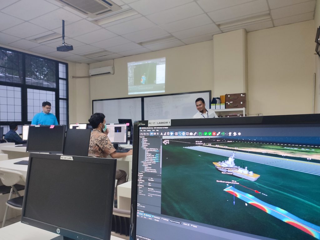
Hydrographic survey simulation
The training was joined by a total of four participants, ranging from the Category A Hydrographic Surveyor Programme students, academic staff and research fellow of the Hydrography Research Group, technician of the Hydrography Laboratory, and selected undergraduate students. Software Licenses were made available by PT. Geotronix Pratama Indonesia.

Dr.rer.nat. Wiwin Windupranata, Coordinator of the Category A Hydrographic Surveyor Programme, handing out a Certificate of Appreciation to Mr. Wahyu Arif Wibowo