Written by: Mentari K. Azzahra
Graduate students of Geodesy and Geomatics Engineering of Bandung Institute of Technology collaborated with PT GPS Land Indosolution in a Total Laser Scanner (TLS) data acquisition process on 21 July 2025. Mentari Khoerunnisa Azzahra (15121023) and Dwi Hadi Nugraha (15121047) are students of the Fast-Track Undergraduate-Master’s Program (PPSM) who are working on theses related to Light Detection and Ranging (LiDAR) and underwater photogrammetry under the guidance of Gabriella Alodia, Ph.D., Dr. Fickrie Muhammad, and Dr. Arnadi Murtiyoso (INSA Strasbourg, France). TLS itself is a laser-based scanning technology that can map objects quickly and accurately, which results in three-dimensional models. Overland objects scanned by TLS will be used as a comparison to the results of underwater object mapping obtained through Underwater LiDAR and underwater photogrammetry technique using a Remotely Operated Vehicle (ROV) to ensure the validity and accuracy of the resulting model.

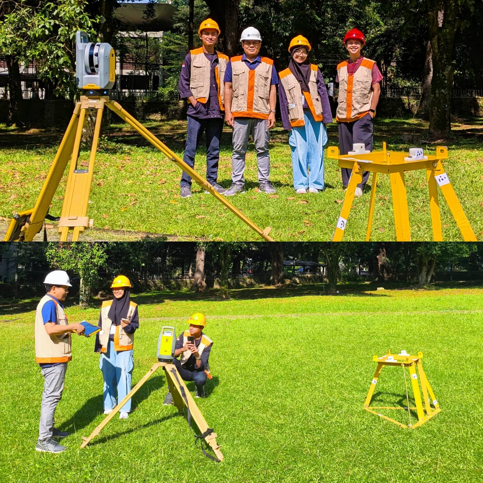
Top: Dwi Hadi Nugraha, Zaeini (Senior Surveyor at PT GPS Land Indosolution), Mentari K. Azzahra, and Gabriella Alodia. Bottom: Data acquisition process.
The TLS data acquisition was carried out with direct assistance from PT GPS Land Indosollution, represented by Mr. Zaeni (Senior Surveyor). The scanning process was conducted using the Trimble X7 TLS device, with the scanned object being an Acoustic Doppler Current Profiler (ADCP) frame – a device used to measure ocean current velocities at various depths.
To achieve a complete 3D representation, the scanning was performed from multiple stands. The ADCP frame was pre-equipped with visual markers that are easily recognised by processing software, thus facilitating a smoother registration process, which involves integration of scan data from multiple positions into a single and coherent coordinate model. The scanning process produced high-density point cloud data, with each TLS position requiring only approximately two minutes of scanning time.
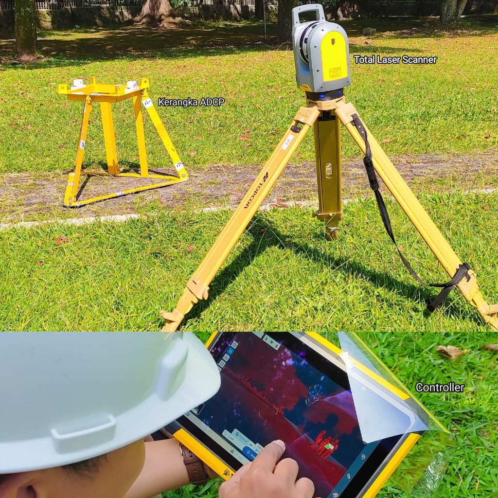
Parts of the field data acquisition process
In the next stage, the 3D model of the ADCP frame generated from the TLS scanning will be compared to models obtained using Underwater LiDAR and underwater photogrammetry technique from ROV inspection, scheduled to take place in Panggang District, Seribu Islands National Park from 19 to 28 September 2028.
The Underwater LiDAR (ULi) system is developed by the Fraunhofer Institute for Physical Measurement Techniques (IPM), currently being tested in collaboration with the Hydrography Research Group at HafenCity Universität Hamburg (HCU). Meanwhile, underwater photogrammetry acquisition will be performed using a low-cost ROV currently being developed by the ITB research team.
This entire activity is part of the research initiative titled the DEEP-UNDER ROV Project (Development of Experimental and Exploratory Photogrammetry for Supporting Underwater Archaeological Studies using Remotely Operated Vehicle) funded by the Directorate of Research and Innovation or DRI ITB through the 2025 Young Lecturer Research Programme. The project, led by Ishak Hilton P. Tnunay, Ph.D. from the Computer Engineering Research Group of STEI ITB, aims to develop a technically feasible and low-cost ROV capable of performing underwater archaeological inspections, particularly in shallow waters across Indonesia. In addition, the project also combines various underwater survey techniques, from a standard hydrographic survey using acoustic methods to the novel techniques previously described to support precise mapping of underwater archaeological sites.