Written by: Muhammad Syahrul Tasyrifan & Madam Taqiyya
A team of students and lecturers from the Hydrography Research Group, Geodesy and Geomatics Engineering Study Program, Institut Teknologi Bandung, carried out a dissemination activity for a dashboard product that provides tidal and weather information on 19–24 September 2025 in Pramuka Island, the Thousand Islands.
Tides and weather are essential information for the continuity and smooth operation of tourism activities in coastal and archipelagic regions. Tidal phenomena can affect marine transportation, snorkeling, diving, and ecotourism management. Likewise, rapidly changing weather conditions often pose challenges in ensuring the safety and comfort of visitors.
These challenges motivated the team from ITB’s Hydrography Research Group, under the Research, Community Service, and Innovation Program (PPMI ITB), to develop an information system that provides real-time tidal and weather data accessible to the public. Together with four involved students, the team designed a dashboard called “Searibu” as an academic contribution to support sustainable tourism in the Thousand Islands.
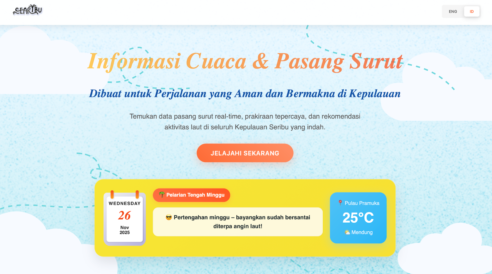
The homepage of the SEARIBU dashboard developed by the Hydrography Research Group, FITB ITB.
“The development of this dashboard is part of hydrography’s scientific contribution to supporting sustainable tourism management. By providing accurate and reliable marine data, we hope visitors can enjoy more certainty and comfort in their activities, while tourism operators can offer high-quality, data-driven services,” said Madam Taqiyya (Lecturer, Hydrography Research Group, ITB).
During the dissemination event on Pramuka Island, the team introduced the Searibu dashboard to various stakeholders, including international and domestic tourists, local government through the Tourist Information Center, and tourism industry actors such as dive center managers, the Thousand Islands National Park Office, and turtle conservation facility managers.
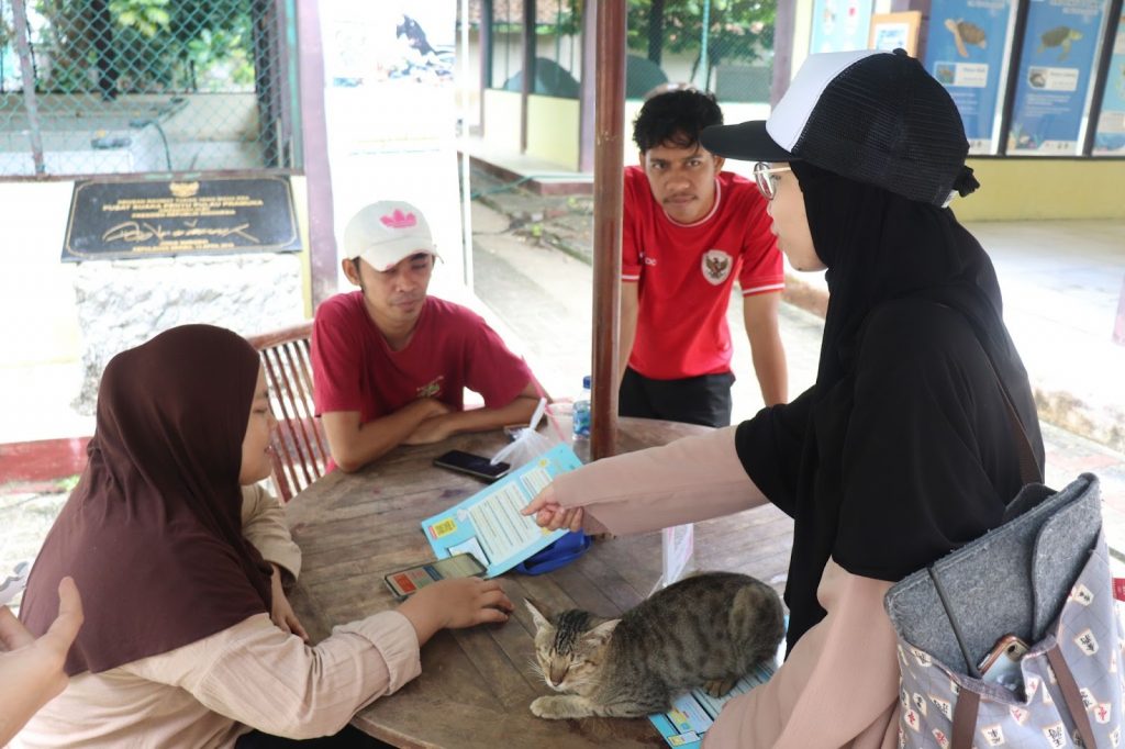
The Hydrography Research Group Team disseminated the “Searibu” dashboard product to tourism stakeholders (turtle conservation managers) on Pramuka Island, Saturday (20/9/2025). (ITB/Muhammad Syahrul Tasyrifan)
At the introduction session, tourists were able to directly try the dashboard, explore its features, and provide feedback for further development. The team received positive responses and valuable suggestions from stakeholders. They noted that the availability of real-time, accurate, and easily accessible tidal and weather data would significantly aid trip planning, tourism activities, and environmental conservation efforts.
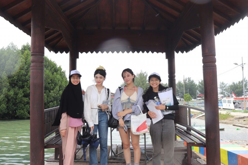
The Hydrography Research Group Team disseminated the “Searibu” dashboard product to international tourists on Pramuka Island, Saturday (20/9/2025). (ITB/Muhammad Syahrul Tasyrifan)
“For now, the dashboard we designed still has limited data and focuses on Pramuka Island. In the future, we hope to expand its coverage to make it more relevant for tourism activities across the Thousand Islands,” said Evin (Geodesy and Geomatics Engineering, Class of 2022).
With the presence of the Searibu dashboard, tourism activities in the Thousand Islands are expected to grow while maintaining safety, comfort, and environmental sustainability.