Featured image: Copernicus Data Space, Sentinel-2 Imagery.
Written by: Eka Djunarsjah
Satellite Derived Bathymetry (SDB) is a method for estimating shallow water depths using optical satellite imagery. Unlike conventional bathymetric surveys that rely on ships with echo sounders (such as Single Beam or Multibeam Echo Sounders) or airborne LiDAR, SDB leverages the ability of sunlight to penetrate the water column and reflect off the seafloor. Satellite sensors, like those on Sentinel-2 or Landsat, record the intensity of this reflected light at various wavelengths (primarily blue and green, which have the best water penetration). By analyzing changes in this reflectance intensity, SDB algorithms can correlate them with water depth. This process can be more clearly understood by observing Figure 1.
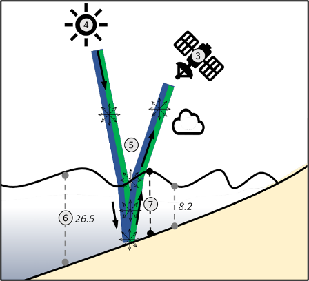
Figure 1. Illustration of SDB method (Source: IHO B-13, Guidance to SDB)
The SDB method offers several advantages: cost efficiency, broad area coverage, and the ability to access waters that are difficult or dangerous for conventional surveys. While its accuracy varies depending on water clarity and atmospheric conditions, SDB has proven to be a reliable tool for bathymetric mapping in shallow waters, especially in coastal and island regions.
The determination of a country’s maritime boundaries is a crucial aspect of its sovereignty and the management of its maritime resources. This process begins with the establishment of the basepoint, which are the outermost point on a country’s outermost islands, taken at the coastline during the lowest tide (see Figure 2). From these baseline points, maritime zones such as the territorial sea, contiguous zone, exclusive economic zone (EEZ), and continental shelf are measured.
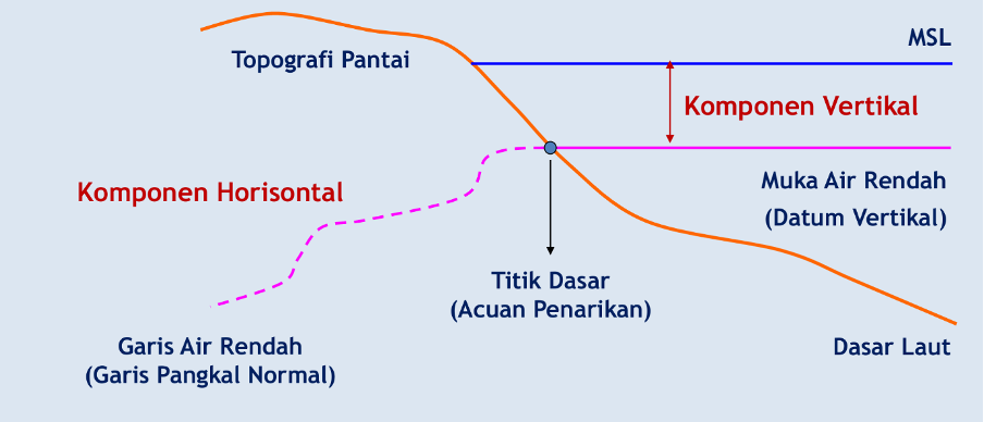
Figure 2. Illustration of basepoint (Source: Eka Djunarsjah, 2023)
Traditionally, establishing these baseline points and conducting bathymetric surveys around them requires intensive, expensive, and time-consuming hydrographic surveys. This challenge is compounded in archipelagic states like Indonesia, which has thousands of remote islands, vast shallow waters, and dynamic marine conditions. Conventional surveys are often impractical or even impossible in these areas, leaving significant data gaps.
With its ability to efficiently map shallow water depths, SDB can be a valuable tool in the process of establishing baselines. For example:
- SDB can help identify and verify positions of the outermost land points, exposed coral reefs during low tide, or other elevations relevant for determining baselines.
- SDB can fill bathymetric data gaps in unsurveyed or hard-to-access shallow waters, providing essential information for establishing baselines in remote areas.
- In geologically or environmentally dynamic regions (such as areas with coastal abrasion), SDB can be used to periodically monitor changes in bathymetry. These changes can affect the position of baselines and require rapid adjustments to maintain the accuracy of a country’s maritime boundaries.
- By reducing the reliance on expensive field surveys, SDB can save national budgets and accelerate the process of establishing maritime boundaries.
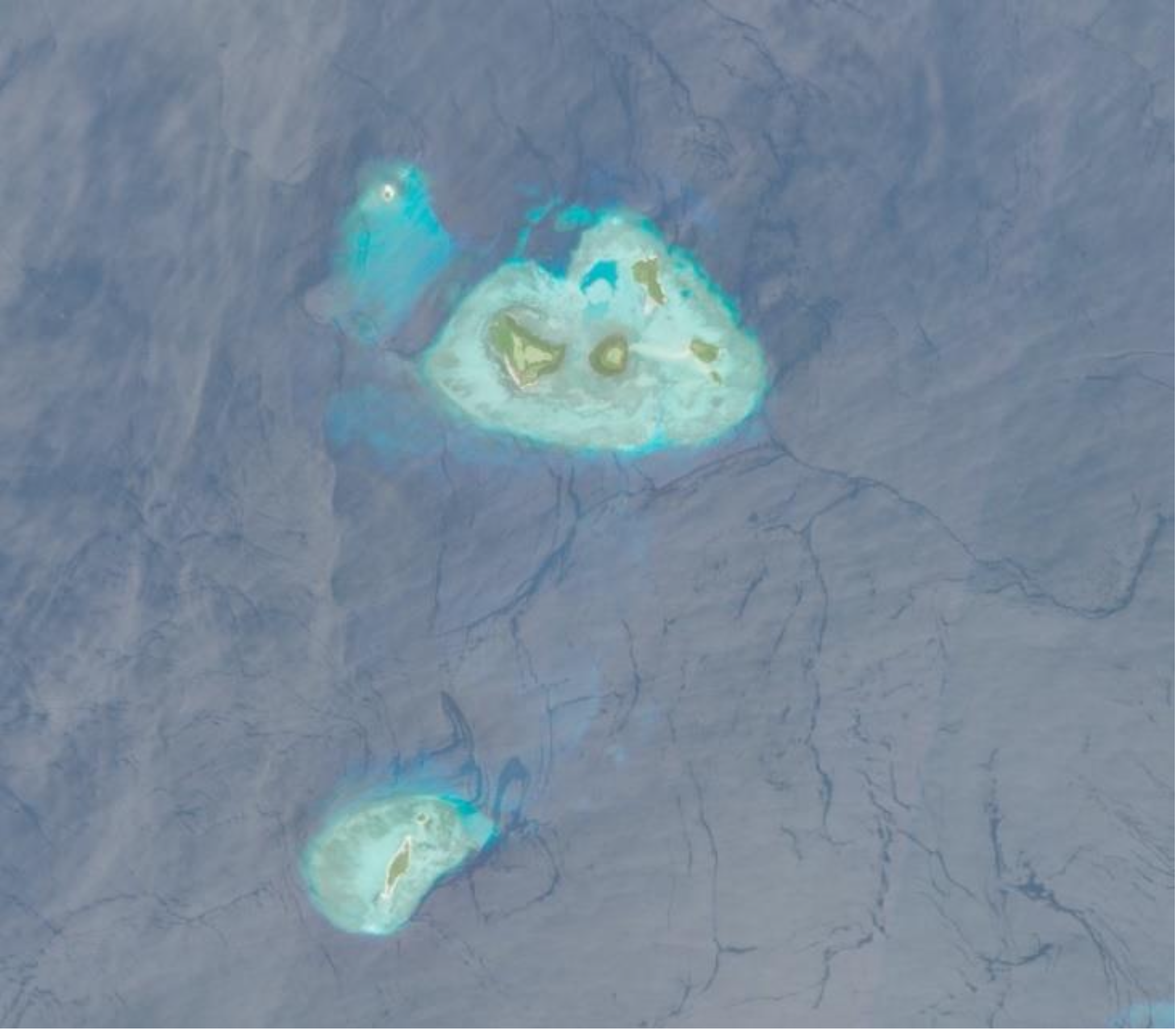
For example, Figure 3 illustrates bathymetric changes around the Tanimbar Islands from April to September 2022. This type of analysis, which highlights areas of significant seabed erosion or accretion, provides crucial data for monitoring coastal and seabed shifts. By regularly generating such data, SDB helps countries like Indonesia to promptly identify changes that may affect the location of their baseline points, thus ensuring the ongoing accuracy and integrity of their maritime boundaries in geologically dynamic regions.

Figure 3. Bathymetric Changes derived from SDB in Tanimbar Islands (Source: Muhammad Zaidan Nafis, 2025)
While SDB offers great potential, it is important to remember that its results must be interpreted carefully, especially in areas with poor water quality or depths that exceed the limit of light penetration. However, as an efficient and wide-coverage complementary tool, SDB can revolutionize the way countries manage and establish their maritime boundaries, ensuring more accurate and up-to-date maritime sovereignty.