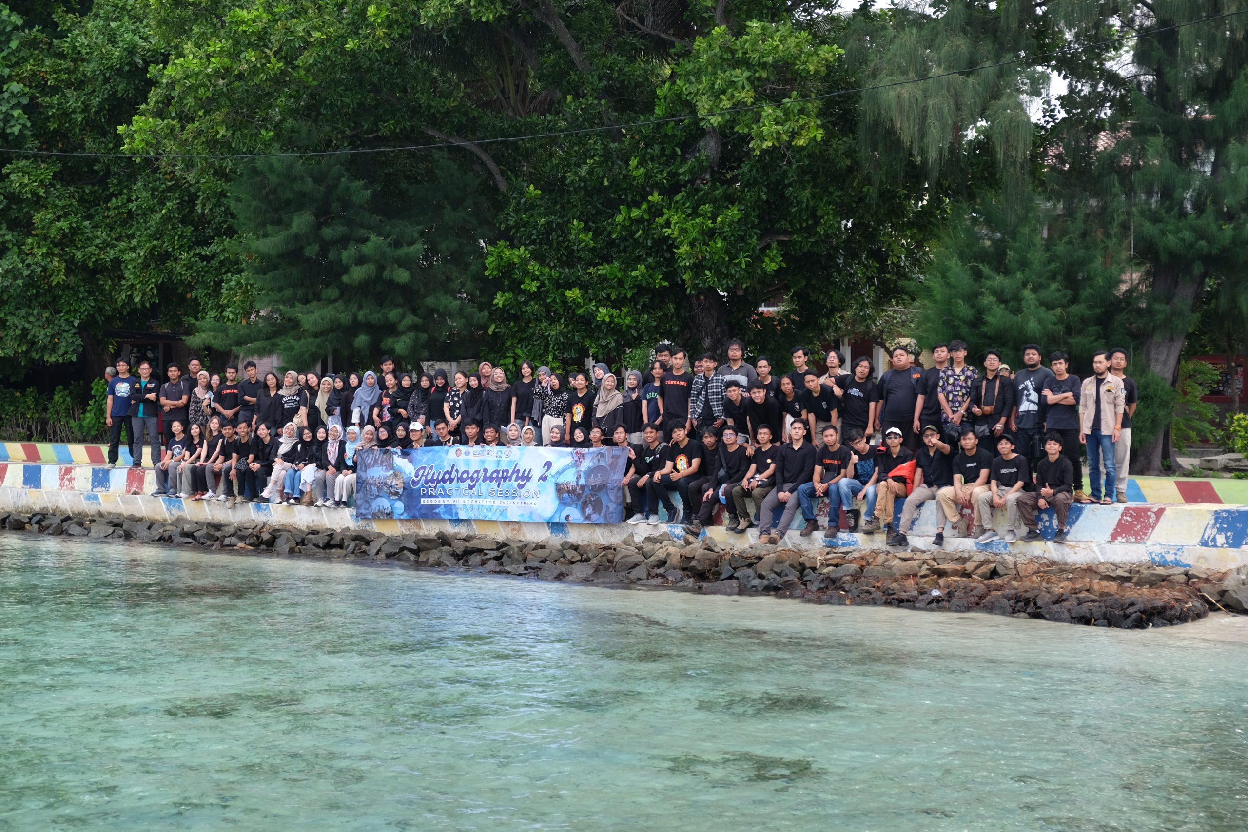
Written by: Adrian Lubis (15121016) and Putri Nur Azizah (15121011)
On 3-5 May 2024, we carried out Hydrography II Practical Session in Pramuka Island, north of Jakarta, as part of the mandatory courses of the third year batch of Geodesy and Geomatics Engineering Undergraduate Programme. In this course, we focused on the dynamics of the water column, including tides, currents, waves, and meteorological parameters. The practical session aimed to provide the students hands-on experience in field data acquisition, data processing, and analysis while adhering to strict Health, Safety, and Environment (HSE) protocols. This practical session was special, because it was the last time Hydrography II was listed as one of the mandatory courses in Geodesy and Geomatics Engineering Undergraduate Programme before the implementation of the 2024-2029 Curriculum. Therefore, we would like to document our experience well in this article!
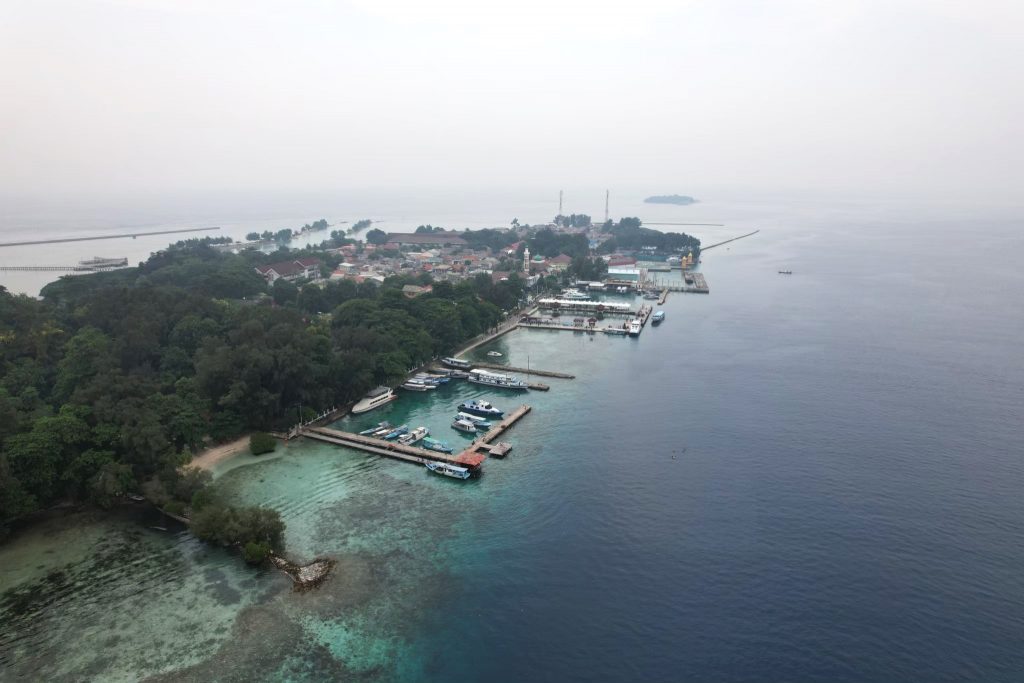
Northwest view of the Pramuka Island
Field description
Pramuka Island is part of the Panggang District, Seribu Islands Regency, DKI Jakarta, Indonesia. It is located within the world’s coral triangle, known for its rich underwater biodiversity. The seafloor in this area ranges from around 25 to 70 metres in depth. The tides are semi-diurnal with a range of up to 0.8 metres. The current is relatively calm, with speeds typically around 0.3 m/s. The wave height can vary between 0.5 and 1 metre, reaching up to 3 metres in extreme weather. The area experiences northwest monsoons from December to March and southeast monsoons from May to September, affecting the wind and wave conditions. The practical session was carried out in May as the area experienced climate transition during this month, resulting in calm weather and clear water.
Practical session modules
The practical session was divided into six modules, which are: (1) Tidal observation and transfer of level, (2) Meteorological parameters observation, (3) Water properties observation, (4) Current observation, (5) Tidal observation and datum transfer, and (6) Team wrap-up. Each module was carried out by two teams at a time within the period of two days.
In the first module, each team carried out manual tidal observation at Pramuka Island alternately from 02:00 pm on Day 1 to 06:00 am on Day 3 in continuous manner. In addition, pressure-based tide gauge was installed alongside the tide pole as a comparison to the manually observed water level. Tidal observation was also carried out in the fifth module, specifically at Panggang and Karya Islands. Transfer of level was carried out to an established benchmark on Pramuka Island and to a temporary pseudo-benchmark on Panggang and Karya Islands.
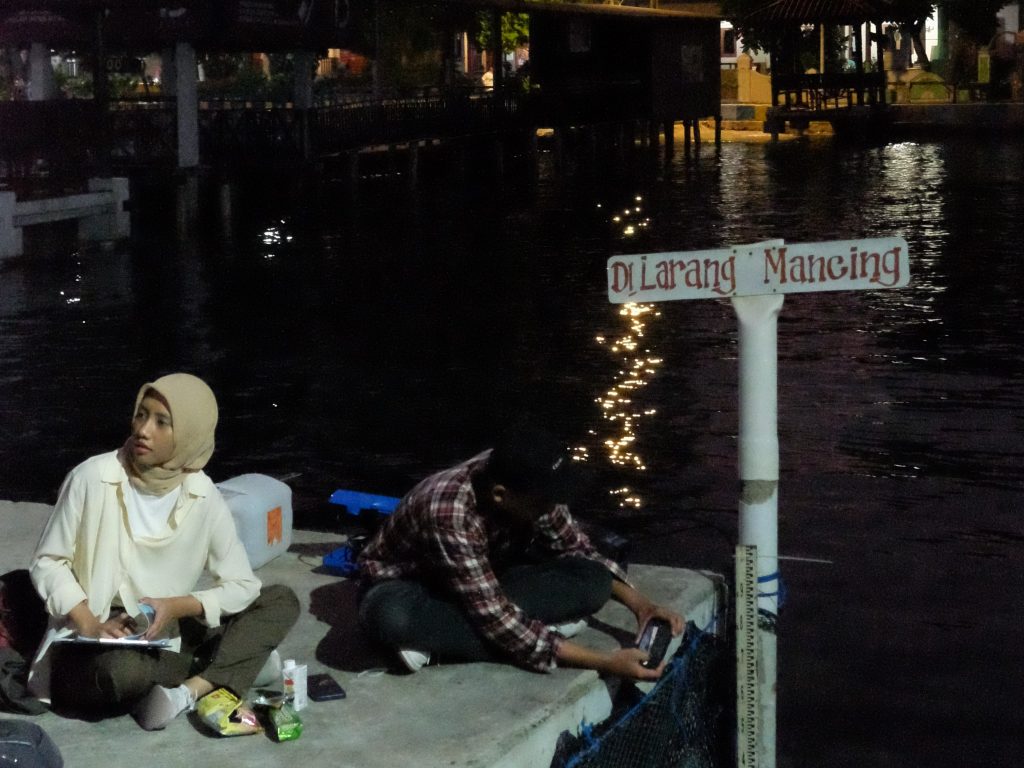
Continuous manual tidal observation at Pramuka Island
In the second module, we carried out meteorological parameters observation using an automatic weather station (AWS). We observed wind velocity, wind direction, air temperature, humidity, air pressure, and rainfall rate on Pramuka Island. Observational meteorology is essential in hydrography as hydrographers rely on observational meteorology to navigate, manage, and protect water resources and aquatic ecosystems.
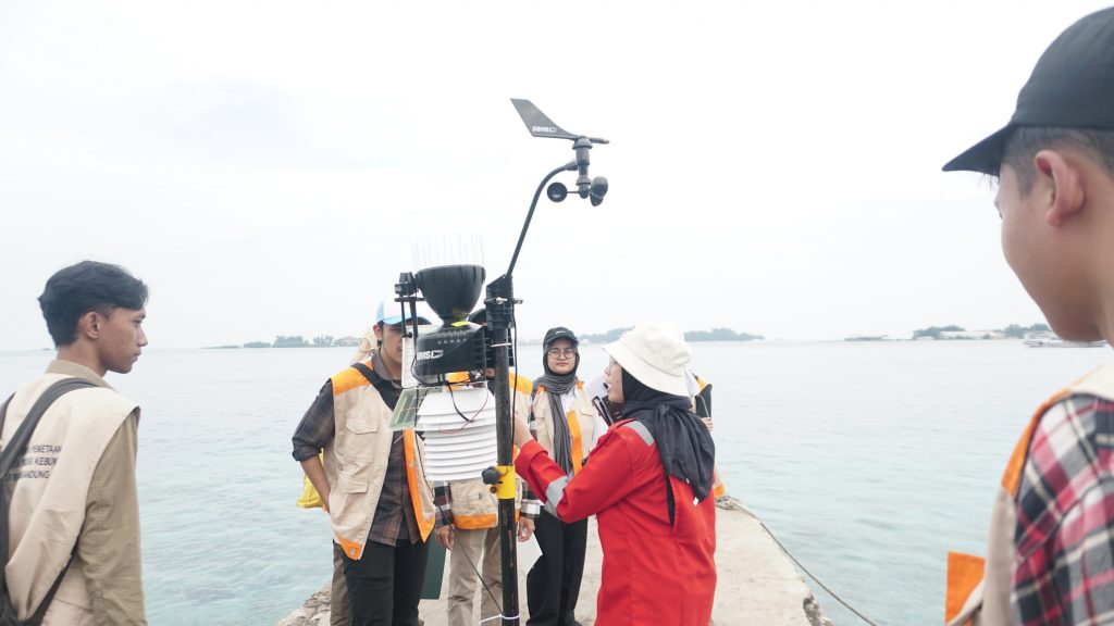
Meteorological parameter observation using AWS
In the third module, we carried out water properties observation using a conductivity, temperature, and depth (CTD) profiler and a Niskin bottle. The CTD profiler was used to obtain vertical profiles of salinity and temperature in the study area, while the Niskin botttle was used to sample the seawater in a specific depth. Usually, water samples were taken into a laboratory for a thorough examination of its content, e.g., salinity, oxygen content, density, etc. In this practical session, we did not bring any water sample back to campus as the goal of this module was to give students an field experience on carrying out water sampling at sea. The physical properties of seawater vary depending on its location, influencing the speed at which an acoustic wave travels through the seawater.
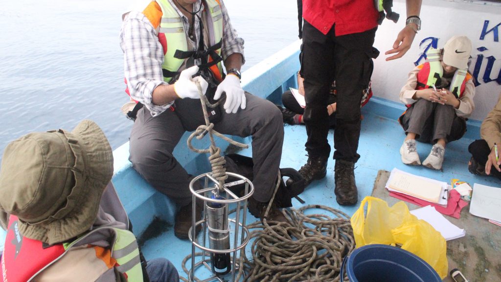
Water properties observation using CTD profiler
In the fourth module, we carried out current measurement using two types of instruments: (1) Acoustic Doppler current profiler (ADCP) and (2) Ultrasonic current meter. Both instruments employ Eulerian current observation method, in which the instrument was deployed at one single point. ADCP measures currents throughout the water column within an assigned time interval and period. In this practical session, the ADCP was installed on a bottom-mounted frame for around 26 hours. Groups 7 and 8 were the lucky ones, as they were given a chance to witness the instrument deployment on the first day! The instrument recovery was carried out by the Category A Hydrographic Surveyor students. Meanwhile, each group carried out current measurement using the ultrasonic current meter close to where the ADCP was deployed. The main difference of this instrument compared to the ADCP is that this type of current meter can only measure the horizontal components of the current.
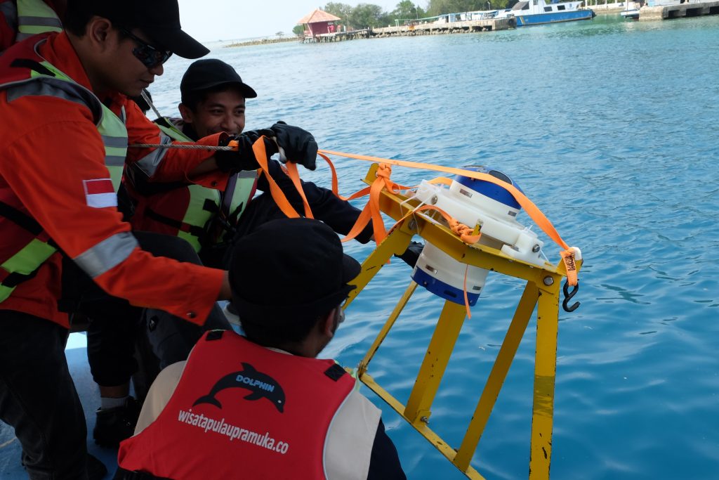
Bottom-mounted ADCP deployment
In the final module, we discussed and summarize all other modules with Bu Gaby to deepen our comprehension of each module and how they relate to each other. Through this module, we were given a chance to understand the concepts, targets, and desired output of the whole field work.
HSE practices
The practical session adhered to high HSE standards to minimise hazards and promote sustainable practices. Students were equipped with personal protective equipment (PPE) and were instructed on proper conduct to avoid injuries and environmental damage. Parts of the key safety measures included protection from the sun and rain, proper handling of personal health issues, and safety protocols for sailing and interacting with marine life. Along with carrying out the modules, we were given responsibilities to look after each other’s safety through the reinforcement of STOP Cards. As each module was carried out by two groups at a time, each group will look after the other during the whole practical session. This method was applied to increase our awareness to the health and safety of one another, including during the free time!
Safety on land…
…and safety at sea!
Free time!
After lunch time on Day 2, we were given quite a long free time window from 02:00 to 05:00 pm. We spent the time to snorkel around Pulau Air and enjoy our time at Gosong Petrik. It was a delightful time after a stressful half of the semester in campus! Finally, we could relax our muscles, heal our minds, and admire the beautiful seas with gorgeous marine life.
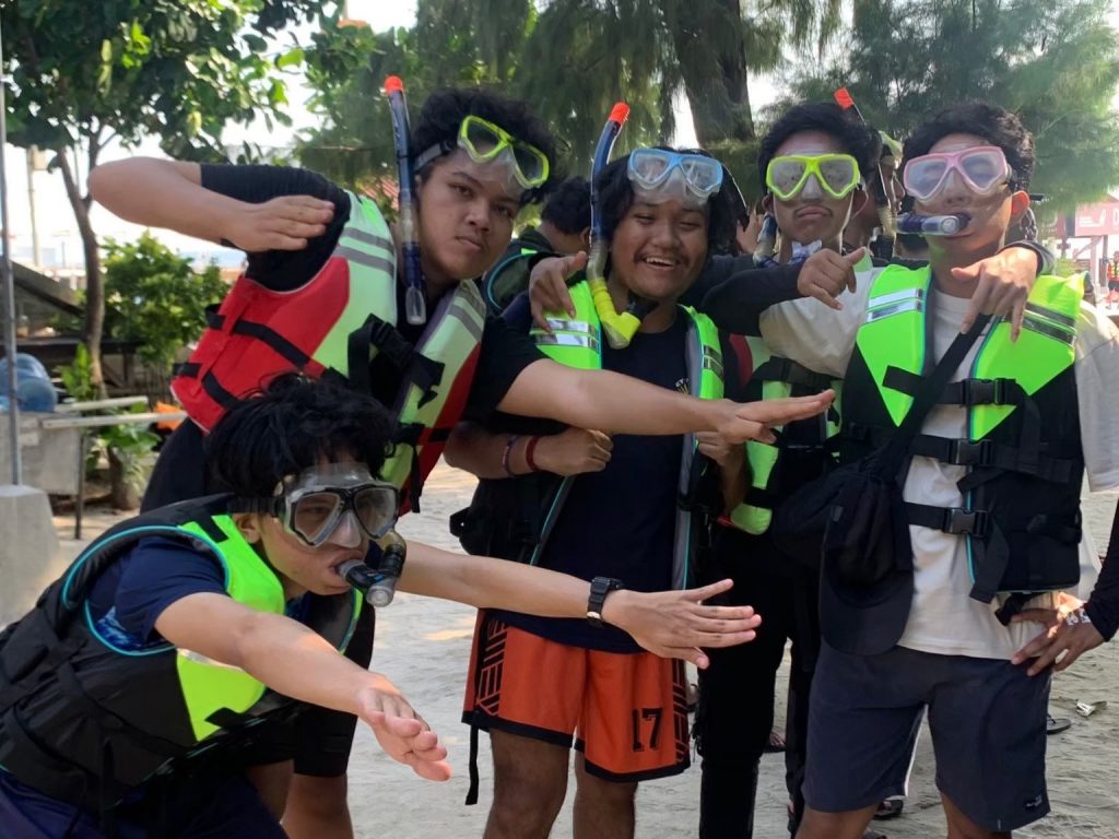
Snorkeling preparation
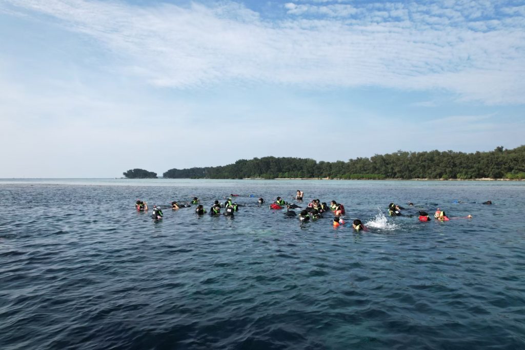
Snorkeling time!
In conclusion, the practical session provided us with valuable hands-on experience, specifically in water column and meteorological parameters observation to support hydrographic practices. Through rigorous field observation, data processing, and analysis, we gained a comprehensive understanding of the materials given in classrooms, contributing to our knowledge and skills in hydrography!