Satellite Derived Bathymetry (SDB) and Its Potential Role in Determining Maritime Boundaries

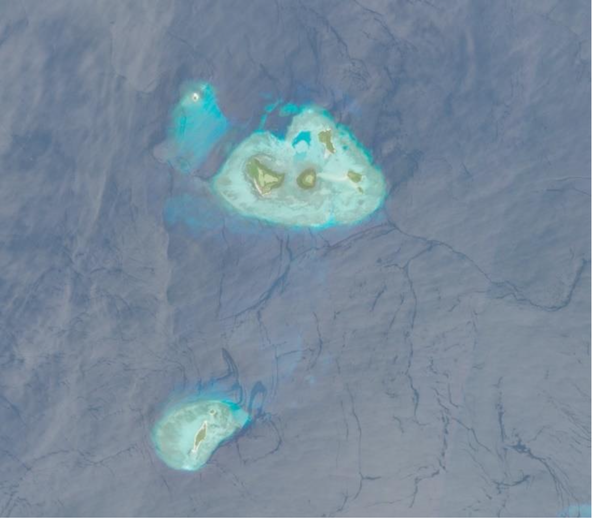
Featured image: Copernicus Data Space, Sentinel-2 Imagery. Written by: Eka Djunarsjah Satellite Derived Bathymetry (SDB) is a method for estimating shallow water depths using optical satellite imagery. Unlike conventional bathymetric surveys that rely on ships with echo sounders (such as Single Beam or Multibeam Echo Sounders) or airborne LiDAR, SDB leverages the ability of sunlight…

Read More

Exploring Marine Weather: Diurnal Rainfall and Shifting Phase during Strong Northerly Wind over Northern Coast of Java Island

Featured image is private assets Written by Madam Taqiyya During the rainy season, you might hear someone say, “Let’s go out before 4 p.m., because it will probably rain after that.”  How do they know? Perhaps, without even realizing it, they have learned to recognize the diurnal rainfall pattern in their area. Diurnal rainfall pattern means repeated…

Read More

RISING University Network Faculty Immersion Programme – NTU Singapore

Written by Gabriella Alodia On July 14-16, 2025, FITB ITB, represented by Gabriella Alodia, Ph.D., participated in the RISING (Republic of Indonesia – Singapore) University Network Faculty Immersion Program organized by Nanyang Technological University (NTU), Singapore. This program is part of a research and education collaboration between the Government of Indonesia and Singapore. The activity…

Read More

Standard Hydrographic Echosounders might Underestimate Depths: Bathymetric Surveys in Shallow Muddy Environments

Written by: Poerbandono The mapping of seafloor topography has been largely relying on standard hydrographic echosounders. Sounds propagate effectively in seawater. Their natures are well recognized and become the basis of knowledge in the design of underwater surveys’ technology. With that, sonar devices (including echosounders) are hence developed and fortified with specific features for different…

Read More
Conference hotel Hydro 2024.

Hydro 2024: See you above and below, Rostock Warnemünde, Germany

Written by: Fickrie Muhammad Hydro 2024, held in Rostock Warnemünde, highlighted emerging trends shaping the future of hydrography. A key focus was the generation of high-resolution seabed data by positioning sensors closer to the ocean floor. Advancements in marine robotics—whether above water, on the surface, or underwater—dominate current developments in the field. The conference also…

Read More

Towards Disaster Risk Reduction and Resilience

Written by: Iyan E. Mulia A chapter by Dr. Iyan E. Mulia, a Hydrography Research Group member, has been published in a book entitled “Probabilistic Tsunami Hazard and Risk Analysis: Towards Disaster Risk Reduction and Resilience” (https://doi.org/10.1016/C2022-0-00360-3). The book comprises a collection of articles from tsunami experts globally. The chapter discusses the application of machine…

Read More